Spekplek
 Communitree
Support
Location
Make this Notebook Trusted to load map: File -> Trust Notebook
Coordinates:
-33.947959999999995, 18.4779
Description
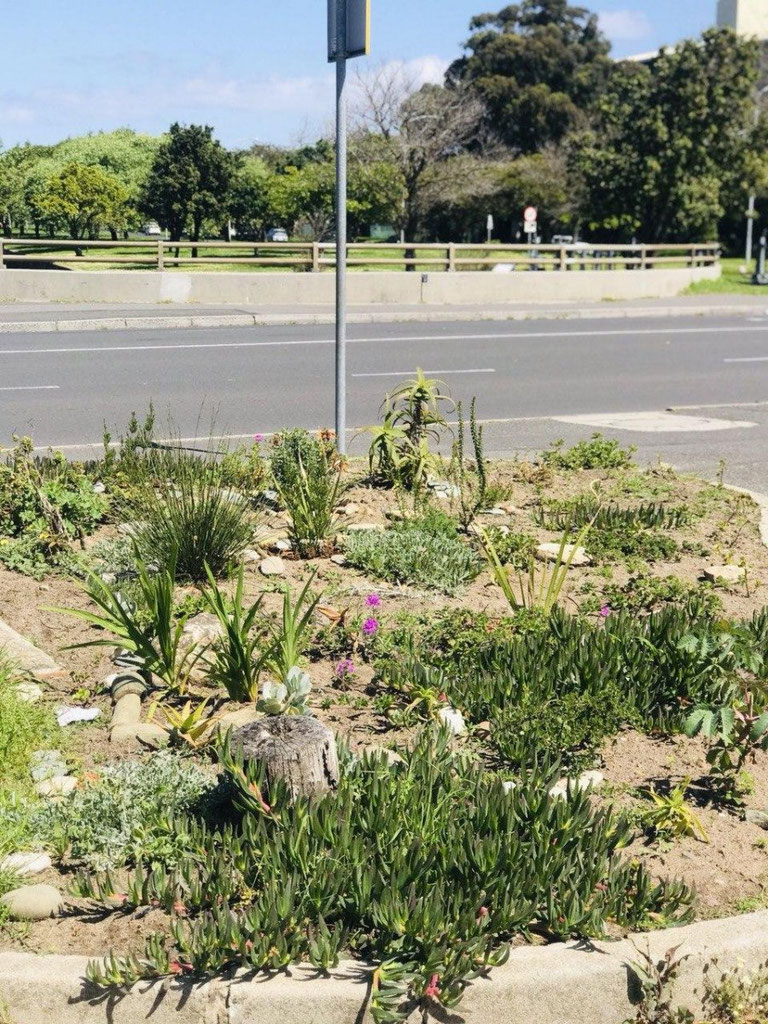
Situated next to the Liesbeek river, on a traffic island, between Klipfontein road and Gloucester road, next to St George´s Grammar School. This was previously a completely abandoned patch, with invasive grass and nothing else growing here. Thanks to the tireless efforts of a group of local volunteers, this patch is now a thriving fynbos garden!
More information
Species list analysis
Location plant profile
Lists the plants that are most appropriate for this location
Site analysis
Site analysis profile
provides an overview of this location, including nearby features and corridor building opportunitiesUpdate information
Do you want to update information on this page? Click here.